

30.09.2015 – 09.10.2015


 10.10.2015


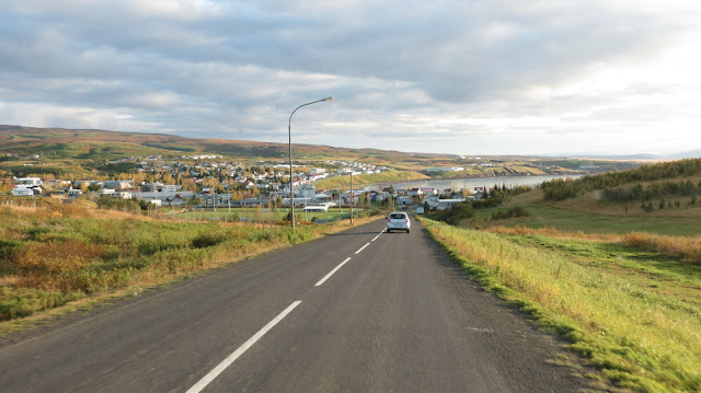
With the end of the summer we decided to follow our dream for a pure Icelandic winter in the North. In the end of September our job contract with the camper rental company in the South in Keflavik, Reykjanesbær was done. We found a job in the North through an ad in the farmer’s newspaper, so we packed our bags and headed north to our new home, though we had no idea where it was. Because we didn’t know where to go and how to get there we decided to find transport to some bigger town in the area. We contacted our future boss and he decided to pick us up with his car from Akureyri (population: 18 191) – the second biggest city in Iceland after the capital Reykjavik (pop. 121 822). We had to choose how to get to Akureyri though – by bus or plane. As much fun as hitchhiking is it wasn’t a good idea in this case because of the weather in the country during that time of the year, which is, as always, unpredictable… This time we decided to do it another way, which has been more and more popular in the recent years – car sharing, and that’s how we got to Akureyri and met our employer to travel together even further north.
Дойде краят на лятото, а с него ние решихме да последваме мечтата си за истинска исландкса зима в севера. В края на септември прикючи лятната ни работа с камперите в Кеплавик, Рейкянесбер. Бяхме видяли една обява за работа в северна Исландия от фермерския вестник, подредихме раници и отпътувахме на север към бъдещата ни къща, която не знаехме точно къде се намира. Тъй като не бяхме много сигурни как да стигнем до мястото, решихме да си намерим транспорт до някой по-голям град в тази област. Свързахме се с бъдещият ни шеф и той реши да дойде да ни вземе с кола от Акурейри (Akureyri, 18 191 жители) - вторият по-големина град в Исландия след Рейкявик (Rejkyavik, 121 822 жители). А до Акурейри можехме да избираме дали да пътуваме със самолет или с автобус. Колкото и да се забавляваме с пътуването на стоп, в този случай не беше никак подходяща опция най-малко заради метеорологичните условия по това време на годината в Исландия, а те са непредвидими... Този път заложихме на друг, в последно време популяризирал се, начин на предвижване – споделянето на кола и така достигнахме Акурейри, където се срещнахме и запознахме с бъдещият ни разботодател и се запътихме заедно още по на север.
We drove through Húsavík (pop. ~2500), where we had a short break to get groceries and then kept going. We were entering the area Кelduhverfi, really beautiful and covered with estuary and lagoon lakes with an outlet on the Greenland Sea, and it turned out our house is next to one of the lakes. Iceland is often called a ‘bridge’ between two continents. The island is on border between the European and North American tectonic plates. On the map below you can see the ‘bridge’ between the plates, which are slowly moving away from each other. This leads to the high volcanic activity in Iceland and also as a result the ground is separating and forming many lakes in the Кelduhverfi area, which is on the north end of the ‘bridge’.
Минахме през града Хусавик (Húsavík, население около 2500 души), където имахме кратък престой за пазар и продължихме още на север. Достигнахме до Кelduhverfi – изключително красив район с няколко лиманни езера с излаз към Гренландско море, оказа се че къщата ни се намира до едно от езерата. Често определят Исландия като „мост“ между два континента. Страната се намира на границата между две тектонски плочи – Европейската и Северно Американската. И на картата по-долу може да видите „мостът“ между двете плочи, които се движат в противоположна посока, което води и до високата вулканична дейност в Исландия. В резултат на отдръпването на тези две тектонски плочи една от друга, земята се е нацепила и са се образували множеството лиманни езера в района Кelduhverfi, намиращ се в северната част на този „мост“.
Something very typical for the whole country (except the capital) is that due to the large area inhabited by only a handful of people (200 000 people outside the capital) and the large number of animal farms the density of the houses/farms is very low and every one of them has a name. Everyone is extremely friendly and hospitable. Here are a few photos from the place where we live right now and the area.
Характерно за страната извън района на столицата, най-вече поради голямата площ на страната, малкото на брой население и многото ферми с животни, е че гъстотата на къщите е много малка и всяка къща/ферма си има име. А хората са изключително гостоприемни и дружелюбни. Ето и малко снимки от и около мястото, на което живеем сега.


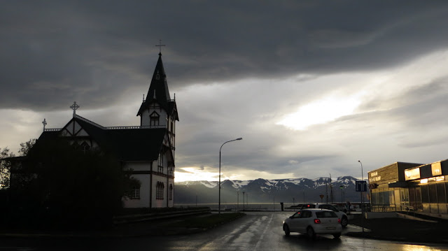
A few days later we drove to the nearest town Húsavík again, for groceries, which is 40km away from our place, and there are two big supermarkets there. The town is lovely and surrounded by impressive snowy peaks. Húsavík is the Whale Capital of Iceland and is the most popular place for tourists who want to go whale watching. There are two major companies, who offer boat rides and with a little bit of luck everyone who goes on these tours can see different types of whales, including the blue whale, the biggest animal on Earth, and the heaviest to have ever lived on our planet.
Няколко дни по-късно отново отидохме до близкия град Хусавик (Húsavík) на пазар, който се намира на около 40 км. от нас и там има два големи супермаркета. Градчето е много красиво и е заобиколено от впечатляващи снежни върхове. Хусавик е столицата на китовете в Исландия (Whale Capital of Iceland) и съответно е най-популярното сред туристи място за гледане на китове. Има две основни фирми, които предлагат разходки с лодки и с малко късмет всеки, който отиде на туровете, може да види различни китове, включително и син кит, който се счита за най-едрото животно в момента и най-тежко животно, живяло някога на Земята.

Húsavík, North Iceland
Хусавик, Северна Исландия

Húsavík, North Iceland
Хусавик, Северна Исландия


Húsavík, North Iceland
Хусавик, Северна Исландия

Húsavík, North Iceland
Хусавик, Северна Исландия
During the next days we started working in a fish farm and factory that produces Arctic Char. Iceland is the biggest producer of that kind of fish and there are a total of 17 commercial farms/factories in the countries, aside from all the private fishermen, of course.
През следващите дни започнахме работа в една ферма и фабрика за риба - арктическа пъстърва (Arctic Char). Исландия е най-голямият производител на този вид риба, а в страната има общо 17 ферми/фабрики за риба с търговска цел, а освен тях има и много малки частни рибари.
In October the colorful carpet of autumn has covered the whole of Iceland. And everything is at least as beautiful as during the summer.
През октомври красивите цветове на есента са навсякъде в Исландия. И тя е също толкова красива, колкото лятото.


There is no season for the breathtaking sunrises and sunsets in Iceland – they are a permanent source of inspiration. During the summer (especially in the end of June, when the day is 21 hours and the night – 3) you can enjoy very long sunrises and sunsets that take hours and there is enough time to experiment with taking photos. After that with each day the night grows longer until the end of December, when the day is 3-4 hours and the night around 20. During the cold and dark months of the year the sun appears and then disappears again really quickly, but is still as beautiful. The good thing is that there are big chances of seeing the Northern Lights, which are really mesmerizing.
За красивите изгреви и залези в Исландия няма сезон, те са целогодишен източник на вдъхновение. През летните месеци (особенно в края на юни, когато денят е 21 часа, а нощта 3) човек може да се наслаждава на много дълги няколко-часови изгреви и залези и съответно има предостатъчно време да екпериментира със снимки. След това с всеки следващ ден, нощта расте до към края на Декеври, когато очакваме ден по 3-4 часа и нощ по около 20 часа. През по-студените и тъмни месеци на годината залезите и изгревите са изключително кратки, но хубавоот през този период на годината е, че доста често има Северно сияние, което е главозамайващо красиво.


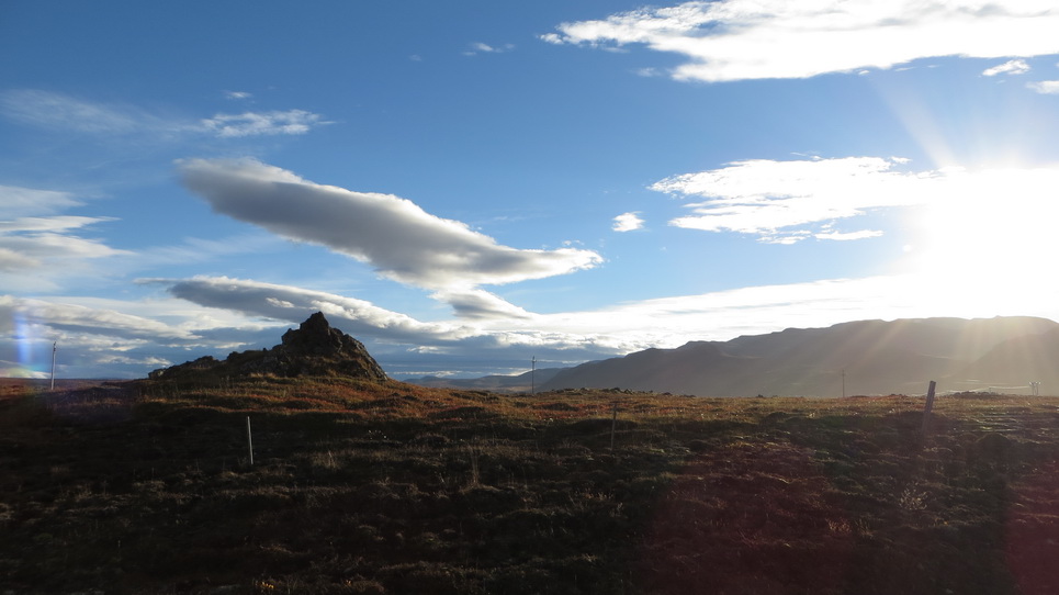
In our first free day from work we decided to go to the waterfall Dettifoss, the most powerful in Europe, which also happens to be a mere 50 km away from our place. You might think that’s nothing, half an hour with a car… but it’s not! On the way there it turned out the off-road trip to get to the waterfall is a lot more powerful. It took us 5 hours driving to get from our house to it, with an average speed of less than 15 km/h. There are two ways to get there, we went one way on the way there and the other way on the way back, hoping it would be faster. On the way there we drove by these rocks, we don’t know a thing about them except that the place was amazing (and that the ground was probably separated in this way because of the tectonic plates moving in opposite directions).
През първия почивен ден, решихме да отидем до водопада Dettifoss, който е най-мощният водопад в Европа и е на някакви си 50 км от вкъщи. Сигурно ще си кажете нищо работа, половин час път.. да, ама не! Отидохме да видим мощен водопад, само дето оф роуда беше по-мощен. За отиване от вкъщи до водопада и връщане обратно отидоха 5 часа само в шофиране. Средната ни скорост беше около 15км/ч. Има два възможни пътя от тук до водопада, ние пътувахме по единия на отиване, а на връщане пробвахме другия с надеждата, че ще се придвижим по-лесно и бързо. На отиване минахме покрай тези скали, за които не знаем нищо, освен че са красиви (и вероятно земята се е разделила по този начин заради отдалечаването на двете континентални плочи една от друга).

Here are some photos we took on the way to the waterfall, driving on an F Road (forbidden for cars without 4x4, most of the roads in the central part of the country are F Roads).
Ето и малко симки от пейзажи по пътя както и от самия път, който е F road (F road – пътища забранени за коли без 4х4, преобладаващи главно във вътрешността на страната).


The road was not easy to drive on but we saw more beautiful landscapes than we could’ve imagined and felt like we were driving through so many wild areas, it was a completely different world.
Пътят не беше никак лесен за минаване, но пък ни се напълниха очите от какви ли не красиви пейзажи, през доста диви места минахме, направо си е друг свят.
And this is the waterfall, 44m high and 100m wide, with a capacity of 193m3/s. It is a popular tourist attraction in the Diamond Circle, which requires more time.
Ето го и водопада, висок е само 44 метра, широк е 100 метра, а дебитът му е 193м3/сек. Водопадът е част от популярен туристически маршрут Diamond Circle, за който обаче е необходимо повече време.

Dettifoss Waterfall, Northern Iceland
Водопадът Dettifoss, Северна Исландия
Next to this waterfall there is another one, here’s a photo of it as well. It’s called Selfoss (there is also a town in Southern Iceland called like that).
До този водопад имаше и един друг, даваме снимка и от него. Казва се Selfoss, има и град в южна Исландия с това име.

Selfoss Waterfall, Northern Iceland
Водопадът Selfoss, Северна Исландия
*****
No comments:
Post a Comment